Ipiranga Museum

Past
imagined

Model of the City of São Paulo in 1840 – Paulista Museum – USP

The model of the city of São Paulo in 1840 is located on the premises of the Museu Paulista, and its restoration is part of the preparation for the exhibitions of the New Museu do Ipiranga in 2022.

It was manufactured in 1922 by Henrique Bakkenist based on 19th-century cartographic maps.

TOP_BLACK__Maquete__Museu_PaulistaTOP_BLACK__Maquete__Museu_Paulista-1

Huginn Flying was hired by Pauliceia Arquitetura e Restauro to carry out the 3D scanning The scale model will serve as a basis for developing a damage map, one of the requirements of the restoration process.

FRONT_W-E__BLACK__Maquete__Museu_PaulistaREST__FRONT_W-E__BLACK__Maquete__Museu_Paulista

Starting from cloud (template) of points Orthophotos were generated at a scale of 1000 pixels per meter (one pixel per millimeter) and used for damage mapping.

LEFT_N-S__BLACK__Maquete__Museu_PaulistaREST_LEFT_N-S__BLACK__Maquete__Museu_Paulista

Upon completion of the restoration work, the idea arose for a new 3D scanning session (point cloud), recording the final appearance of the model. Naturally, we carried out this scan after the restoration.

During the scanning process of the model, we wondered which buildings were represented and which ones still exist. We were unsure about some of them, whether they were indeed the ones we thought.

Although the description of the work states that there is no scale measurement, we wondered how accurate this model would be, so the idea arose to compare the point cloud of the model with the point cloud of the city of São Paulo in 2017 (PMSP 2017).

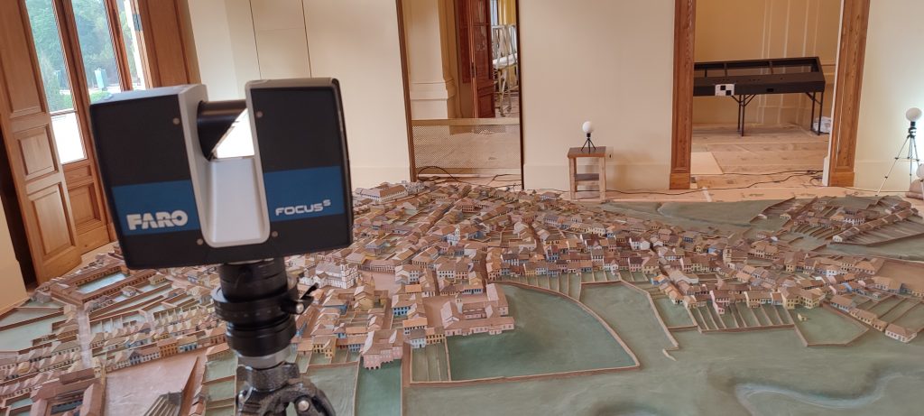
I selected two points in approximately the same locations in the two clouds: at the top of the tower of Pateo do Collegio and on a corner of Saint Benedict Monastery.

Based on these points, I scaled and aligned the cloud in the model with the one in the... PMSP And the result showed that it was very close to the current layout of the region. This alignment allowed us to correctly identify the locations and, for us, to discover some buildings that still exist today.

NUVEM_MAPA__02__Maquete__Museu_PaulistaNUVEM_MAPA__03__Maquete__Museu_Paulista
 
NUVEM_MAPA__02__Maquete__Museu_PaulistaNUVEM_MAPA__03__Maquete__Museu_Paulista

On the HFLY portal you can see the model's cloud, the camera's position on the current map, and also the cloud of... PMSP and even jump to the 3D view of Google Maps as shown in the movie “A stroll through São Paulo in 1840”" below.

Premium WordPress plugins