
Dates: from April 7th to June 30th, Tuesdays.
Hours: 8:30 AM to 12:30 PM.
Course duration: 48 hours.
Registration: Complete and submit the online registration form. Starts on February 12th, ends on March 27th. link.
Course fee: R$ registration fee 50.00 (fifty reais).
Payment method: bank slip (cash payment).
Exemption: Public school teachers and USP graduate students can request free access by sending an email to [email address]. apoioacadmp@usp.br until the end of the registration period, with proof of affiliation.
Openings: 200
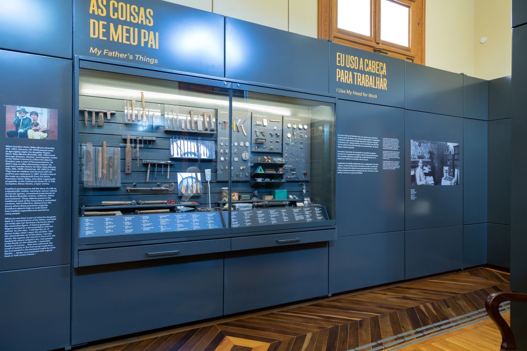
Location: Auditorium of the Ipiranga Museum.
Presenter: Jorge Pimentel Cintra.
Target audience: General public with a university education.
A certificate will be provided to participants with 75% attendance at the event.
The course will present basic topics in the history of cartography in São Paulo, with practical exercises in reading maps from the collection of the Museu Paulista.
The classes will be interspersed with an overview of the evolution of cartographic techniques, mainly regarding latitude and longitude measurements, cartographic projections, and prime meridians.
Among the approaches covered in the course will be map reading, paleographic reading of place names, critical analysis of maps as a documentary source, and cross-disciplinary studies of cartography in relation to science and art.
PROGRAMME
1. Course Presentation. Objectives and teaching methods. The relationship between the history of Brazilian and São Paulo cartography. São Paulo in the first maps of Brazil. Map reading techniques.
Reading exercise: Terra Brasilis (Pedro Reinel and Lopo Homem) and Luis Teixeira.
2. The cartography of Martim Afonso de Sousa's voyage. The letter of Pero Lopes de Sousa and the map of Gaspar Viegas. Martim Afonso and Pedro Nunes.
Reading exercise: Gaspar Viegas' Map and the old maps of the bays of Santos and Rio de Janeiro (Albernaz/Teixeira family).
3. The occupation of Brazilian and São Paulo territory. Symbols of possession on maps and in the territory: flags and shields, possession markers. Donation charters and charters of the captaincies and the power to create villages and distribute land grants. The respective legal documents, pillories and markers.
Letter reading exercises (excerpts): donation to Martim Afonso, town charters, and land grant letters.
4. The formation and representation of the territory of São Paulo, from the hereditary captaincies to the State of São Paulo. The vicissitudes of the territories of Martim Afonso and Pero Lopes de Sousa.
Reading exercise: the reconstruction of the territory of the southern captaincies and the modifications of borders.
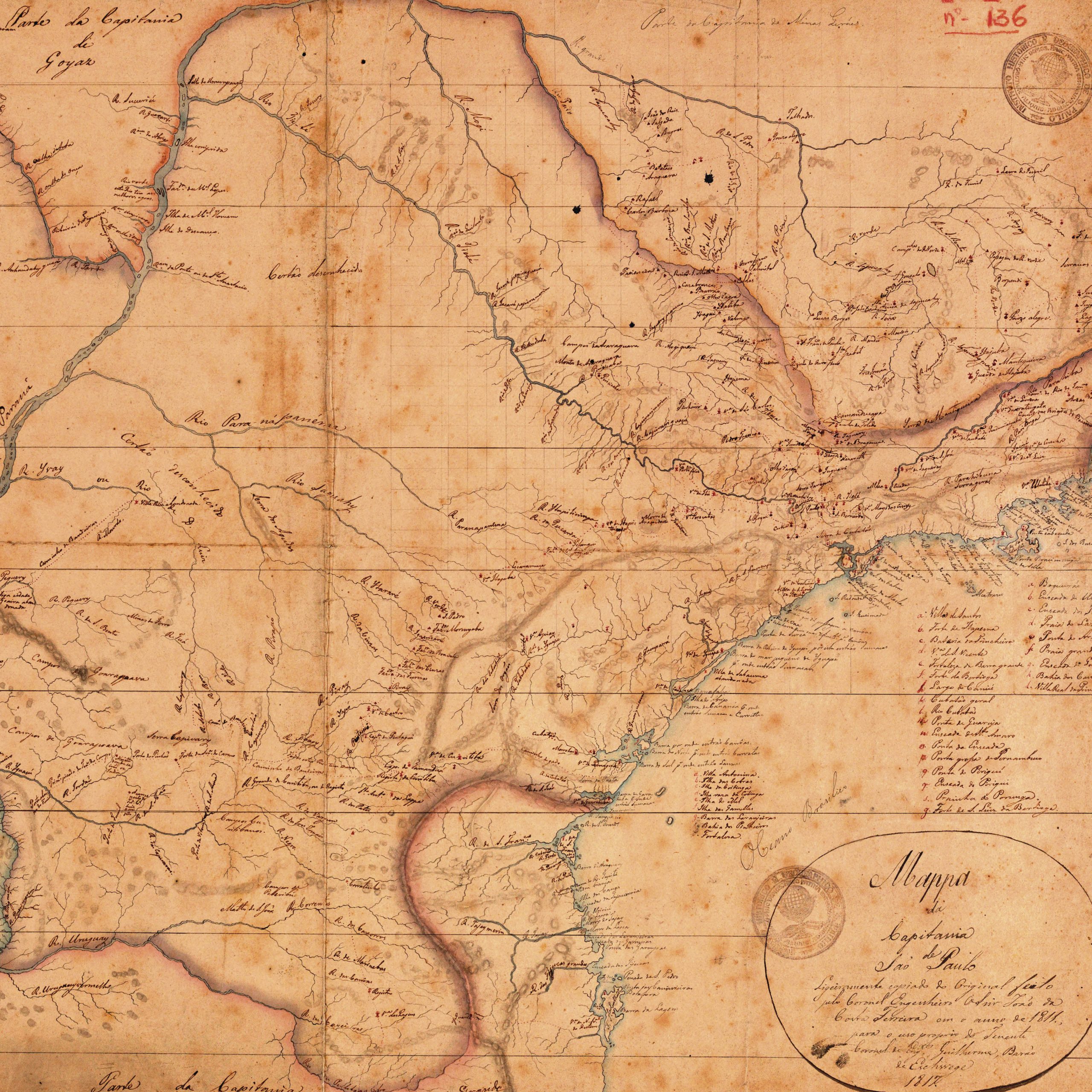
5. Taunay and the first maps of the territory of São Paulo. Room A10 of the Museu Paulista. History and context of the production of the map by Céspedes de Xeria and its copies.
An exercise in reading the map by Céspedes de Xeria and the copy from the Museu Paulista.
6. Delisle and the reform of world cartography. Reflections on the politics of King John V and the reform of cartography in Brazil. The mathematical priests and their work. The instruments of cartographers at the time.
Reading exercises: Delisle's map in light of longitude measurement techniques.
7. The Maps of the Mathematical Fathers. History of latitude and longitude tables. Method of constructing their maps.
Reading exercise: the maps of the Mathematical Fathers in the collection of the Paulista Museum.
8. The border demarcation engineers and their cartographic work in São Paulo, especially Francisco de Oliveira Barbosa, Bento Sanches D'Orta, João da Costa Ferreira and Antonio Rodrigues Matosinho.
Reading exercise: A Collection of Maps of Ancient Paulista Cartography: selected maps.
9. Other maps of the Province of São Paulo: Wilhelm Ludwig von Eschwege (1817), Daniel Pedro Miller (1841), Jules Martin (1878) and Carlos Daniel Rath (1886).
Exercises in analyzing the cartographic quality of historical maps.
10. The map as a historical document for determining the layout of ancient roads. Riches and pitfalls. The importance of consulting sources and comparing them with other documents. Digital cartography programs as a tool.
Exercise: The layout of the old roads from São Paulo to Itu.
11. The Geographic and Geological Commission of São Paulo and the beginning of systematic cartography in Brazil. Its purposes and significance. The exploration of rivers and the determination of the State's borders.
Exercise: reading and analyzing the CGG mapping and its reports.
12. Mapping SARA Brazil. Recovering its history: its pioneering spirit, doubts, and uncertainties. Its technical and informative quality. Its value as a historical document.
Exercise: reading and analyzing the SARA map and the location of the so-called Cry of Ipiranga.